Please wait

Anyone working in the United Arab Emirates (UAE) or GCC knows that our ground conditions are anything but straightforward. We often deal with medium-dense to dense sands transitioning into sandstone or calcarenite, with varying degree of cementation. It’s that grey zone between soil and very weak rock that makes interpretation and design so challenging.

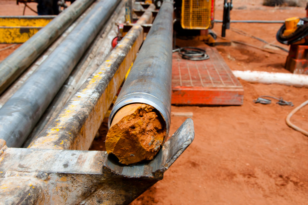
When it comes to standard site investigations, like boreholes, SPTs, and basic coring, most contractors can deliver decent results. But once you step into advanced testing like pressuremeter or advanced tests, geophysical investigations or even CPTs, the difference between an average and a great soil investigation company becomes very clear.

At that level, data quality, rig condition and maintenance, calibration, operator skill, and interpretation experience directly influence the geotechnical parameters that feed into your foundation design. Even small errors in core recovery or a poor understanding of cementation or stiffness transitions, can lead to major misjudgments in foundation behavior, settlement, or retaining wall performance. Details that can lead to significant overdesign and costly project delays later into to the project, when time is precious. 

And here’s a truth we’ve seen time and again across projects in Dubai, Abu Dhabi, Riyadh, and Doha:

You’ll always pay for your soil investigation!

Either upfront, by choosing a competent and experienced team or later, through redesigns, claims, delays, and costly surprises during construction.

As with almost everything nowadays, the cheapest option is rarely the best investment.

High-quality geotechnical investigations in the UAE and GCC don’t just produce better data. They reduce uncertainty, optimize design, and enhance safety, things that eventually would directly impact your project’s budget, schedule and success. 

Perhaps it’s also time for municipalities and authorities to consider setting minimum standards for rig quality, calibration, and operator competence, similar to what’s already in place in the UK, Singapore, and Hong Kong.

After all, reliable design starts with reliable data, and that begins in the field.

Author

OE
Orycta Engineering Consulting
Posted on Nov. 6, 2025, 8:35 a.m.
Share

Comments

Login to add a comment.

Login

Related Blog

Geotechnical Engineering Ground Improvement Techniques
Lessons Learned from Landmark Soil Improvement Projects in the GCC region.

The execution of large-scale soil improvement works across the GCC has provided critical insights into the complexities of working with challenging geotechnical conditions in arid and coastal environments. One key lesson is the importance of tailoring improvement techniques, such as roller compaction, dynamic compaction, vibro-compaction, vibro-replacement and deep soil mixing, to site-specific soil profiles and conditions.

OE
Orycta Engineering Consulting
Posted on Sept. 19, 2025, 8:45 a.m.
Geotechnical Engineering Engineering Software Tools
Beyond PDFs: Dive Beneath with Orycta XPLORE

As geotechnical engineers, we spend countless hours reading, reviewing, and analyzing factual and interpretative reports. But how often do we truly look into our data? Dive into geotechnical data files with Orycta XPLORE.

OE
Orycta Engineering Consulting
Posted on April 4, 2025, 6:54 a.m.
Geotechnical Engineering Soil Analysis Risk Management
Why bother ?

Why bother digitizing your geotechnical data? Ensuring competitiveness in geotechnical engineering in an increasingly data-driven era.

OE
Orycta Engineering Consulting
Posted on Oct. 25, 2024, 10:49 a.m.
Ground Improvement Techniques
Soil densification. Understanding relative density and its role in soil stability

Understanding relative density is essential when it comes to soil densification, particularly for cohesionless soils as it helps engineers make informed decisions about the need for densification and the methods required to achieve the desired soil stability for construction projects.

OE
Orycta Engineering Consulting
Posted on Oct. 18, 2024, 7:01 a.m.
Geotechnical Engineering Soil Analysis
The Casagrande Plasticity Chart

The Casagrande Plasticity Chart is a graphical tool used in geotechnical engineering to classify fine-grained soils based on their plasticity characteristics.

OE
Orycta Engineering Consulting
Posted on Sept. 29, 2024, 7:38 p.m.
Geotechnical Engineering
Address early the elephant in the room

The challenges of programming and automation in engineering and construction

OE
Orycta Engineering Consulting
Posted on Sept. 29, 2024, 7:36 p.m.
Geotechnical Engineering
Convert your AGS data to Excel

As digitization and visualization of geotechnical data become more and more relevant in today’s fast-paced projects, geotechnical engineers and geologists are increasingly required to deal with vast amounts of data and produce easy-to-read visualization graphs and models.

OE
Orycta Engineering Consulting
Posted on Sept. 29, 2024, 7:33 p.m.

Join Our Community

Are you an engineer passionate for new technologies and programming? Have an exciting project and want to explore what automation and AI can do for you?​ Want to join our growing team or provide recommendations for future developments?

We want to hear from you!

info@orycta.com
image

Connect with us at social media!