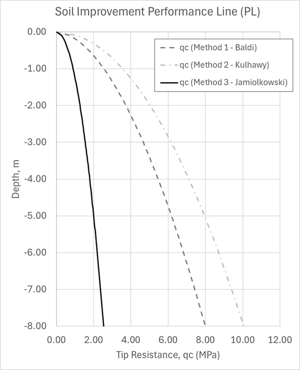
Establishing the performance line for soil improvement is a critical task in geotechnical engineering. The design parameters defined at this stage directly influence construction feasibility, long-term ground performance, risk management, and overall project cost. A well-calibrated performance line ensures that improvement works achieve the required specifications without overdesign, which can lead to unnecessary expenditure and resource use.
Drawing on experience from landmark projects such as The Palm Jumeirah, Palm Jebel Ali, and large-scale developments across Saudi Arabia, valuable lessons have been learned about the challenges of scale and soil variability. One recurring theme is the importance of making design choices that are both technically robust and cost-conscious. On projects where hundreds of millions of cubic meters of soil are treated, even a modest 5–10% improvement in design efficiency can translate into hundreds of millions in savings. These savings can be redirected into innovation, sustainability measures, or simply reducing financial exposure, while still ensuring that geotechnical performance criteria are met.
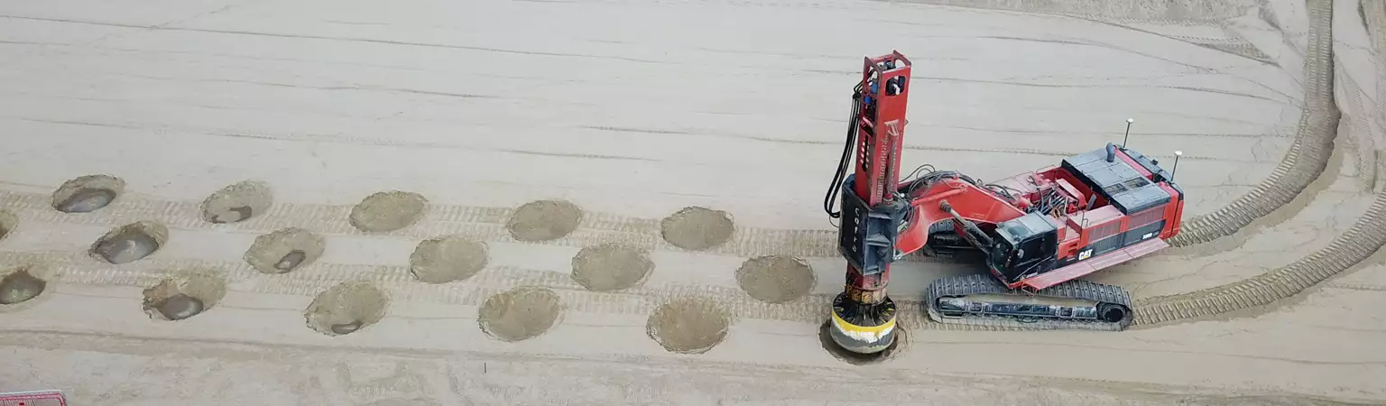
Typical soil improvement design workflows involve suitability analysis of proposed techniques, development of project specifications, preparation of method statements, and the execution of compaction trial programs. These are followed by detailed pre- and post-treatment assessments, including settlement predictions, bearing capacity checks, slope stability and liquefaction analysis verifications. Each stage is not only a checkpoint but also an opportunity to refine assumptions and validate performance against both empirical results and numerical models.
Advances in 3D modelling and parametrized design tools have further enhanced the ability of engineers to simulate soil-structure interactions and optimize improvement strategies. By leveraging such tools, it is possible to evaluate multiple improvement techniques, such as roller compaction, rapid impact compaction, vibrocomopaction, stone columns, or deep soil mixing, and select the method most compatible with site-specific conditions. This technical independence ensures that the final solution aligns with both the geotechnical requirements of the soil and the performance expectations of the project.
Ultimately, the lessons from these landmark GCC projects underline that soil improvement is not only about achieving compliance with design criteria, but about optimizing efficiency, reducing uncertainty, and ensuring resilience of the built environment. For geotechnical engineers, the emphasis must remain on developing designs that are evidence-based, adaptive to complex ground conditions, and capable of delivering value across the full project lifecycle.